Making Maps+ Work for My Fishing
I’ve been a fan of the Deeper Map+ since its inception. Unfortunately, I don’t have the luxury of being able to use a boat, so I’ve spent many a day over the years mapping the lakes I fish from the bank.
My favourite venue is particularly interesting because it’s extremely shallow for at least 50% of the time we are allowed access to fish it. Each March and April, I spend a considerable amount of time mapping this particular water, which covers around 64 acres. All that information is uploaded into Maps+, which I can then access via the internet on any device. It also transfers across to the Deeper App, which can be downloaded onto my phone.
Personally, I prefer to sit at home on my laptop, connected to a large screen. It gives me a much better perspective of the lake and allows me to study the layout in far greater detail than I can on a phone.
I’ve also altered the colour palette to highlight the deeper areas of the lake, which makes them much easier to identify. During the spring, the depth can vary from around 7 feet down to as little as 3 feet, and as the summer progresses, the water level can drop by another 2½ feet.
There are also some very large boulders scattered around the lake, and it certainly wouldn’t be clever to deliberately connect your Deeper Sonar with one of those!
So, this is how I’ve overcome the problem and turned Maps+ into one of my go-to tools during the summer months.
When I’m fishing, I spend a lot of time watching the water and, more importantly, watching where the carp are showing. I take note of their position in relation to my swim and the various horizon markers around the lake — tall trees, gaps between trees, buildings and anything else that gives me a fixed reference point.
Once I’m back home, I can sit in front of my big screen and open Maps+. Using those reference points, I can work out approximately where the carp were showing and then overlay my own Deeper scans to build up a much clearer picture of what’s actually out there.
The same principle can also be used with Fish Deeper Premium.
Putting It Into Practice
On my last session, I’d seen carp showing at around 21 wraps from my swim. The problem was that I was already aware of several very shallow areas between them and me, with some substantial boulders scattered across the bottom.
I knew I was taking a risk by fishing directly towards the carp.
After landing one and losing two, it was time to rethink the whole approach.
Rather than simply continuing to fish where I’d seen the carp, I needed to work out which swim would give me a better angle and, most importantly, allow me to avoid the boulders.
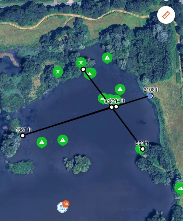
The swims are quite widely spaced around this water, so I couldn’t simply move a few yards along the bank. However, after studying the large-screen version of Maps+ and the bathymetric data I’d collected over the years, I could see that the area I’d been fishing was connected to another section of the lake.
Although I couldn’t fish the exact spot where I’d seen the carp, the important thing was that the depth remained almost identical. I’d also started to wonder whether the carp might actually be travelling in from this other section of the lake.
This gave me another option.
The next step was to use the ruler tool from my original swim, measuring across to the horizon marker I’d been using for casting. I could then transfer that information across to the new swim, work out the distance in wraps and establish which horizon marker I needed to use from the new position.
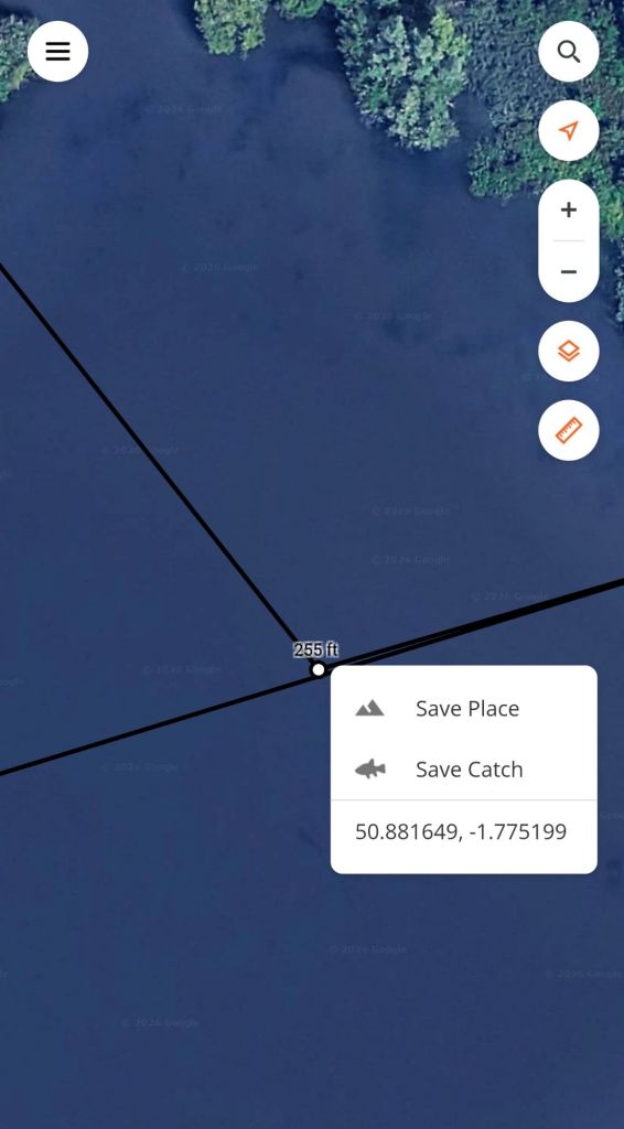
It sounds complicated when written down, but once you’ve got the maps in front of you, it becomes surprisingly straightforward.
The new approach meant fishing between a very shallow area, where the birdlife could now actually stand up, and a slightly deeper area to my right.
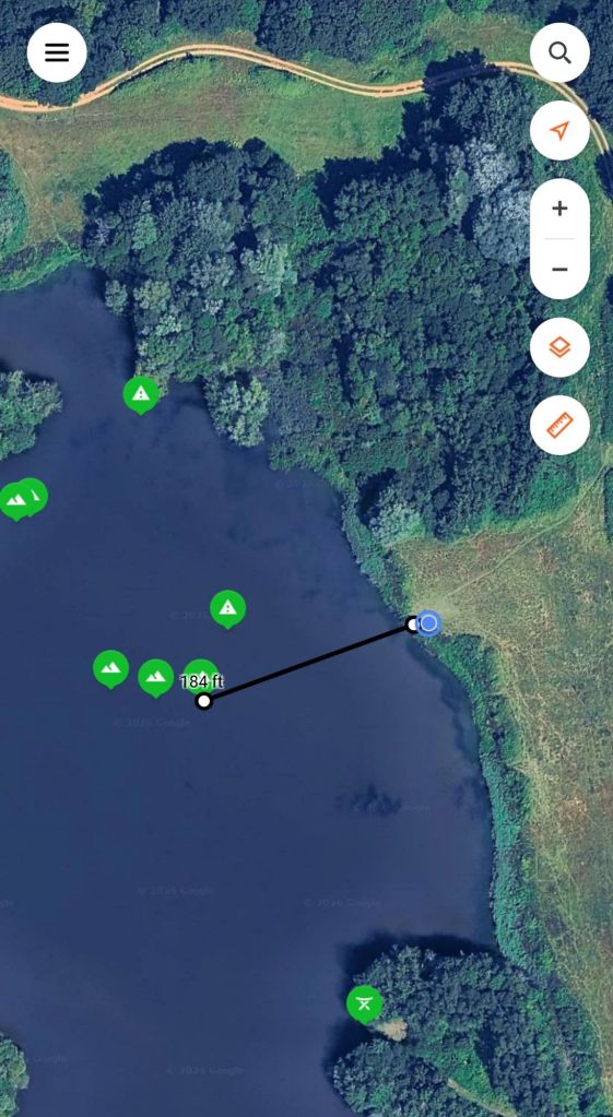
Rather than pushing my luck, I decided to reduce the number of wraps and fish the edge of the deeper area where I’d seen the carp feeding.
For me, this is an important part of fishing.
I want to catch carp, but I’m certainly not a fan of catching them at all costs. If there is a safer way of approaching the fish, I’ll always take that option. The welfare of the carp has to come first.
Building the Spot
The next challenge was getting the carp to move onto my hookbait.
I couldn’t simply put a large amount of bait on the new spot and expect it to work straight away. Instead, I introduced the bait slowly and steadily, working my way back from the original area towards the new spot.
The idea was to gradually encourage the carp to move onto the new feeding area rather than trying to force the situation.
It took nearly 12 hours for the first bite to arrive, followed by another fish a little later.
That was enough confirmation for me that the new approach was working.
I ended up staying for three nights, partly because I knew I wouldn’t be able to fish the following week with the family holiday coming up.
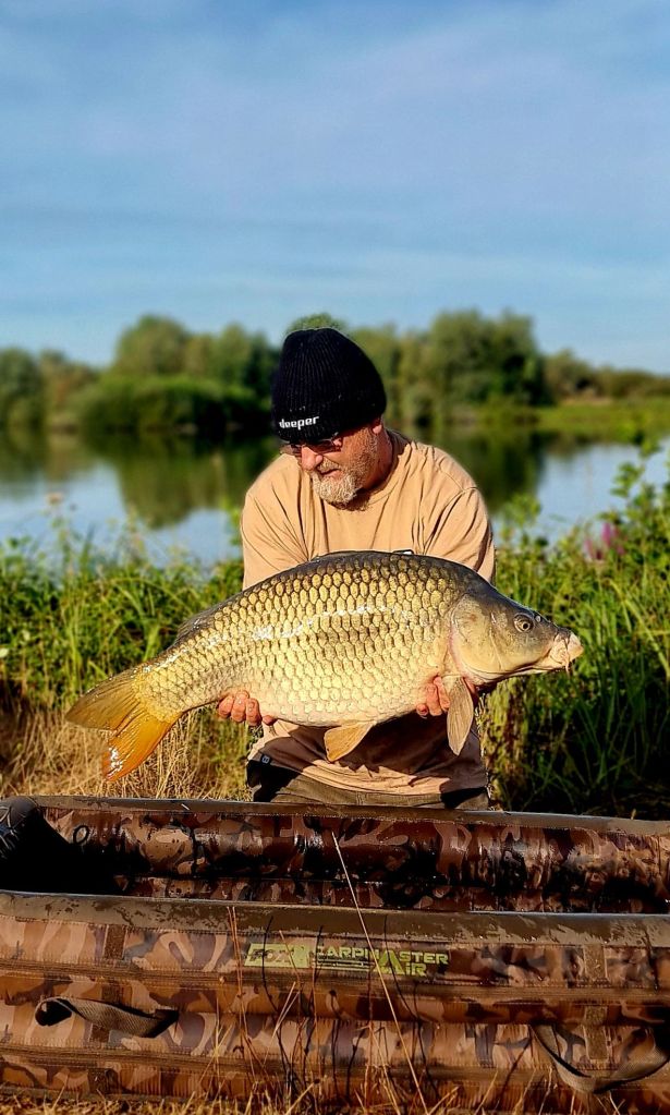
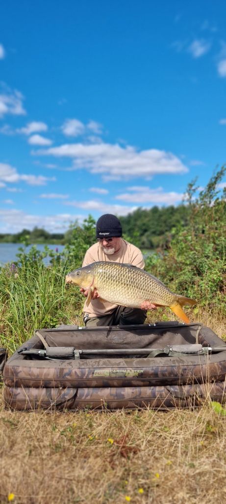
By the end of the session, I’d managed five carp in total, with the biggest two being lovely Commons of 25lb 13oz and 24lb 1oz.
My Go-To Summer Tool
I use this method more often than not these days.
The simple reason is that I’m unable to use a bait boat, and I can’t always get my Deeper Sonar out into the far reaches of the lake. Without the right wind direction, drifting the Deeper out to some of these areas simply isn’t practical, and I’m also very conscious of other anglers fishing around me.
Having already mapped so much of the water I fish, Maps+ gives me another way of understanding what’s happening beneath the surface without having to physically scan every area during a session.
For me, that’s where the real value is.
It’s not simply about having a pretty map of the lake. It’s about building up a picture over time, combining the information from my Deeper scans with what I’m actually seeing on the bank.
The more I use it, the more useful it becomes.
And when you’re fishing a shallow, complicated water with bars, boulders and constantly changing water levels, having that information available on a big screen at home can make a massive difference to how I approach the fishing.
It’s certainly become one of my most valuable tools for working out where to fish, how to fish it and, most importantly, how to do it safely.
Until next time,
Richard


Get 10% off Deeper with Code – RICHARD10